Original photo by naruedom/ iStock
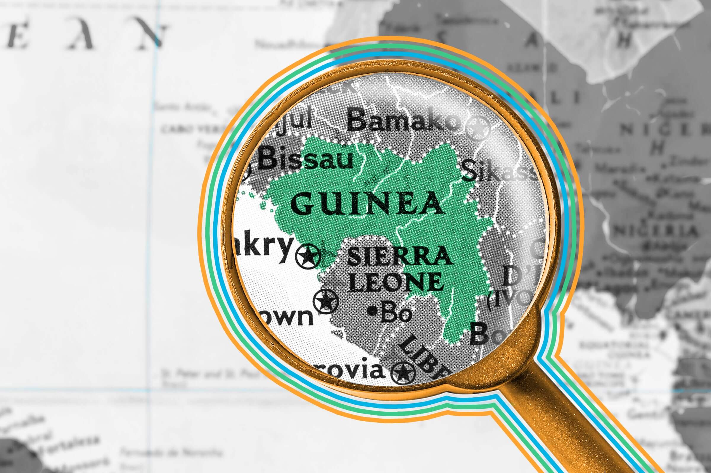
It’s not unusual for cities to share names, but it happens less frequently with countries. Yet four nations — three of which are in Africa — use the word “Guinea” in their titles: Guinea, Guinea-Bissau, Equatorial Guinea, and Papua New Guinea. How is it possible to have so many countries using the same word? It has to do with the colonization of Western Africa. The exact origin of the word “Guinea” is unknown, though some linguists believe the term comes from the Portuguese word “Guiné,” which appeared around the mid-1400s to describe a region south of the Senegal River along Africa’s western coast. A competing theory suggests that the name comes from Djenné, an ancient city in modern Mali that was an important stop along the trans-Saharan gold trading route; it’s possible “Djenné” transformed into “Genawah,” which was then used to describe all people in Western Africa.

Oops, incorrect!
It's a factEquatorial Guinea is the only country on the African continent to have Spanish as one of its official languages, along with French and Portuguese. The nation was a colony of Spain from 1778 through 1968; today about 67% of its citizens can speak Spanish.
By the late 1880s, many European countries had laid claim to African land in a race historians call the “Scramble for Africa.” Spain, France, and Portugal (among other powers) all shared control of the Guinea region in Western Africa; the area was divided, and land was generally identified by its controlling country. However, the names we know today wouldn’t emerge until well into the 20th century, when each nation broke away from European control. French Guinea retained the name Guinea after gaining independence in 1958, Spanish Guinea became Equatorial Guinea in 1963, and Portuguese Guinea took on the name Guinea-Bissau (referencing its capital city Bissau) in 1974.
As for Papua New Guinea, located thousands of miles to the east across the Indian Ocean, two explorers gave it its name. In 1526, Portuguese sailor Jorge de Meneses dubbed part of the island “ilhas dos Papuas,” from the Malay word papuwah (referencing the islanders’ curly hair), while Spanish explorer Yñigo Ortiz de Retez declared another portion New Guinea, believing its citizens resembled the people of Africa’s Guinea coast.

Numbers Don't Lie
More Interesting Reads

Guinea pigs are native to ______.
Ready to reveal?
Confirm your email to play the next question?
Guinea pigs are native to South America.

New Guinea is the world’s second-largest island.
Situated in the western Pacific Ocean, north of Australia, New Guinea (home to most of Papua New Guinea and parts of Indonesia) is the second-largest island on the globe, measuring more than 317,000 square miles. While that may seem large, it’s less than half the landmass of Greenland, the world’s largest island. Making that distinction was probably a tricky feat, however, because mapping New Guinea proved difficult for cartographers for centuries. The island’s rugged terrain — complete with mountains, rainforests, and large wetlands — can make exploring and charting its boundaries difficult; even attempts at aerial photography have often been limited thanks to heavy cloud cover in many areas. It wasn’t until 1971 that mapmakers were able to draft more accurate sketches of the island with the help of radar imagery.

Nicole Garner Meeker is a writer and editor based in St. Louis. Her history, nature, and food stories have also appeared at Mental Floss and Better Report.
top picks from the Inbox Studio network
Interesting Facts is part of Inbox Studio, an email-first media company. *Indicates a third-party property.