Original photo by Albina Gavrilovic/ iStock
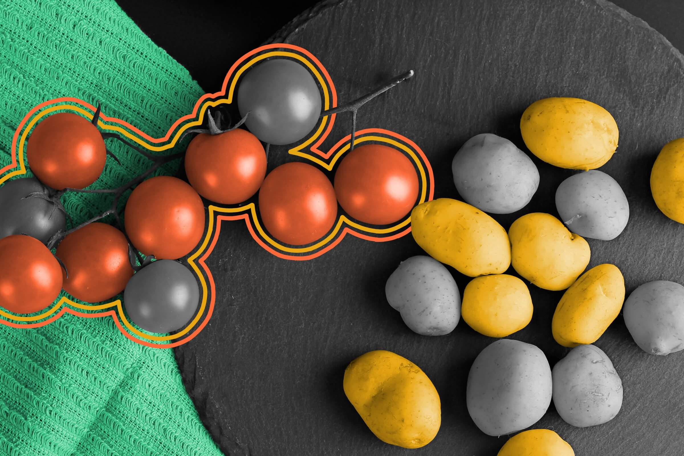
Tomatoes: so easy a potato can grow them. Well, not quite, but the two do occasionally join forces and result in the aptly named “pomato” plant. That two-for-the-price-of-one hybrid occurs when a tomato plant is grafted onto a potato plant, which is relatively easy to do since both belong to the Solanum genus of the nightshade family.
The pomato isn’t its own fruit, however — it’s a plant that grows both foods at the same time: tomatoes on the vine and potatoes under the soil. Peppers, eggplants, and tobacco are also members of the Solanum genus, and tomato plants can be grafted onto them as well.

Nicknamed the “ketchup ’n’ fries” plant and sometimes called “tomtatoes,” these plants have been grown since at least 1833. In addition to the novelty of growing two things at once, pomatoes can benefit from both plants’ natural advantages: potatoes’ cold resistance and tomatoes’ heat resistance. The potatoes and tomatoes grown from these hybrid plants don’t taste any different than their normal counterparts, but they are more convenient to grow.

Numbers Don't Lie
More Interesting Reads


Tomatoes are believed to have originated in ______.
Ready to reveal?
Confirm your email to play the next question?
Tomatoes are believed to have originated in Peru and Ecuador.

Heinz ketchup has a speed limit.
As the brand practically synonymous with ketchup, Heinz has a reputation to uphold. A big part of that image is the consistency and viscosity of its flagship product, which is meant to be thick enough to pour onto your fries at a diner by turning the bottle upside down but not so smooth that the ketchup splatters everywhere.
As part of its quality control process, the company has even imposed a speed limit on the condiment of 0.028 mph, which is checked at its factories. That’s the exact speed at which Heinz ketchup should move when poured upside down from its bottles. This speed limit even inspired a promotional campaign in collaboration with Waze, in which anyone forced to go 0.028 mph while stuck in traffic could get a free bottle of ketchup.

Michael Nordine is a writer and editor living in Denver. A native Angeleno, he has two cats and wishes he had more.
top picks from the Inbox Studio network
Interesting Facts is part of Inbox Studio, an email-first media company. *Indicates a third-party property.