Original photo by Michael Rosebrock/ Alamy Stock Photo

What’s the world’s biggest airport? What about the busiest? Why is there an “X” in PDX? Is there a way to get a nap between flights? And what happens to all the change you leave in airport security bins?

Airports are big, crowded, and full of questions. The following 15 facts might change the way you catch your next flight — or at least end some mysteries.

Plane on the map of the Saudi Arabia.
Credit: futuristman/ Shutterstock

The World’s Largest Airport Is the Size of New York City

King Fahd International Airport near Dammam, Saudi Arabia, has a larger area than any other airport. It’s 780 square kilometers, or about 300 square miles. That’s almost exactly the same size as New York City — yes, all five boroughs. As Guinness World Records points out, it’s larger than the entire neighboring country of Bahrain, which has three airports of its own.

Aerial view of the multiple runways and terminals at Atlanta's Hartsfield-Jackson airport.
Credit: Thomas Barrat/ Shutterstock

ATL Is the World’s Busiest Airport

Hartsfield–Jackson Atlanta International Airport in Atlanta, Georgia, is the busiest airport in the world for passengers, serving 93,699,630 people in 2022 — and aside from a brief blip in 2020, it has held the No. 1 spot since 1998. It’s not even close: The next-busiest airport for passengers, Dallas/Fort Worth International Airport, was more than 20 million people behind in 2022.

So why is it so popular? First, there aren’t a lot of other international airports in the immediate area, so it’s the closest international airport for much of the South. It’s also Delta Air Lines’ biggest hub. It makes a lot of sense for transfers, too. According to the airport, it’s within a two-hour flight of around 80% of the population of the United States — and unlike the major metropolitan areas that you’d maybe expect to be the busiest, it doesn’t have to deal with traffic from other nearby airports.

Pilot greets couple before boarding the luxury mid size private jet.
Credit: Drazen_/ iStock

Celebs Pay Extra for Private Boarding

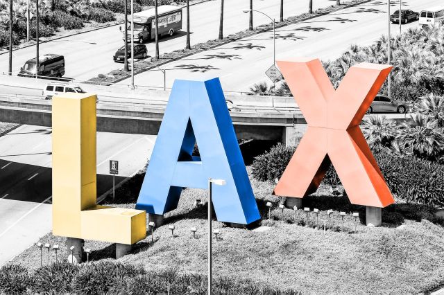
Celebrities do fly commercial, even if they’re flying first class, so why do you never see them sweating in the boarding line with everyone else? Many airports have private or exclusive terminals for the rich and/or famous. LAX (Los Angeles) and ATL (Atlanta) have The Private Suite, which provides comfy accommodations, valet parking, and, as the name suggests, private suites to hang out in while waiting for departure. It even has dedicated customs and security on-site. It’ll cost you, though: Memberships start at $1,250 a year, and that doesn’t even come with a discount for the $4,850 price tag on a preflight suite. It will get you free massages and manicures while you wait, though.

A passenger looking at timetable board at the airport.
Credit: Song_about_summer/ Shutterstock

Airlines Pad Flight Times to Make Planes Look More Punctual

On paper, flights take a lot longer than they used to, even though the airports are located in the same place and the planes haven’t gotten slower. It’s because airlines have started building in some extra wiggle room, so that a plane has a better chance of landing at its destination on time, even if it has a delayed departure. Despite this, around 30% of planes still arrive more than 15 minutes after their scheduled arrival time.

A view of an air traffic controller's screen.
Credit: ninjaMonkeyStudio/ iStock

The World’s Tallest Air Traffic Control Tower Is in Saudi Arabia

Perhaps fittingly for the nation with the world’s largest airport (see above), the world’s tallest air traffic control tower is also located in Saudi Arabia. The tower at Jeddah King Abdulaziz International Airport in Saudi Arabia stands at 136 meters (446 feet), and surpassed the next-tallest tower, at Kuala Lumpur International Airport in Malaysia, in 2017. The tower in Saudi Arabia is about as tall as the Great Pyramid of Giza.

View of Saba island airport from above.
Credit: Guilain Demoutiers/ Shutterstock

The Shortest Commercial Runway Is in the Caribbean

The Caribbean island of Saba, located in the Lesser Antilles, is only around 5 square miles, so there’s not a lot of room for an airport. (The island is also filled with rocky cliffs — it’s the tip of an underwater volcano.) They make do with only 900 feet of usable runway. For context, the typical commercial runway is between 8,000 and 13,000 feet long.

Illuminated entrance of Amsterdam Airport Schiphol at night.
Credit: VLIET/ iStock

An Amsterdam Airport Has a Giant Park Inside

Amsterdam Airport Schiphol has all sorts of quirky, cozy amenities, including a library, an art gallery, and three-dimensional cow tiles, but Airport Park blows them all away. The green oasis opened in 2011, and while the vast majority of the plants are fake, it’s built around the very real trunk of a 130-year-old copper beech tree. To give the illusion of the outdoors, the airport pipes in parklike sounds such as birdsong. Visitors can even hop on a bike that also charges their phone. For a real breath of fresh air, there’s a small outdoor terrace.

The LAX-Sign at the Entrance of the Los Angeles International Airport.
Credit: Michael Rosebrock/ Alamy Stock Photo

In Airport Codes, “X” Is Just Filler

The “X” and the end of “PHX” makes sense for Phoenix Sky Harbor International Airport — but what about “LAX” for Los Angeles and “PDX” for Portland?

Turns out, the “X” is left over from the days when airports used two-letter codes from the National Weather Service. With the rapid growth of air travel, it soon became apparent that two letters wouldn’t be enough. ​​When International Air Transport Association (IATA) three-letter codes became the norm in the 1930s, some airports gained an “X” at the end.

Then there’s Sioux City Gateway Airport, which is blessed with the IATA code “SUX.” In 1988 and 2002, officials petitioned to change the code, and were offered five options by the FAA: GWU, GYO, GYT, SGV, and GAY. They opted to embrace what they already had instead, and introduced a line of merchandise — beanies, mugs, and more — emblazoned with the “SUX” logo.

A plane takes off from College Park Airport in Maryland.
Credit: The Washington Post via Getty Images

The Wright Brothers’ Airport Is the World’s Oldest Continuously Operating Airport

Flight pioneer Wilbur Wright established College Park Airport in College Park, Maryland, in 1909 as a training ground for two military officers as they got ready to fly the government’s first airplane. More than a century later, it’s still a public airport, making it the oldest continuously operating airport in the world.

There’s a little bit of an asterisk on that record, though, in that you can’t really catch a flight there — unless you have or know somebody with an aircraft and a pilot’s license. Which brings us to…

Image Ad
An airbus of the airline Eurowings takes off from Hamburg Airport.
Credit: picture alliance via Getty Images

Hamburg Airport Is the Oldest Continuously Operating Commercial Airport

If you’re looking for the oldest airport with terminals and plane tickets, look no further than Hamburg Airport, established in 1911. But while America was building its aviation history on airplanes, Germany built the facility around the country’s own technology: Zeppelins.

Count Ferdinand von Zeppelin, the inventor of the Zeppelin airship in the 1890s, gave an enthusiastic speech about the future of air travel in Hamburg in 1910. Residents believed in his vision, and the first building at the Hamburg Airport was an airship hangar, built in 1912. However, it took less than a decade for airplanes to start taking over. The airport broke the one-million passenger mark in 1961.

Close-up of an airport arrivals and departures sign.
Credit: JESHOOTS/ Unsplash

Airlines Pay Up to Eight Figures for Slots on the Airport’s Schedule

To keep air traffic running smoothly and safely in more than 200 of the world’s busiest airports, airport operators grant airlines slots that give them authorization to take off or land at certain times — and in many places, demand is far outpacing supply.

The most expensive slots are at Heathrow International Airport in London, England. In 2016, Kenya Airways sold its only slot to Oman Air for a whopping $75 million. That’s on the high side, but eight figures is relatively common. One year later, two slots fetched the same price when Scandinavian Airlines decided to sell.

Because an airline can lose that valuable asset if it doesn’t use it at least 80% of the time in a six-month period, you might see some unusual scheduling. At one point, British Mediterranean Airways was operating round-trip flights between Heathrow and Cardiff Airport in Rhoose, Wales — a journey of just a few hours by car or train — with zero passengers, angering environmental activists (among others). And with demand for air travel having decreased during the ongoing COVID-19 pandemic, some airlines aren’t canceling their underbooked flights, leading to more empty planes journeying through the skies.

Security man at checkpoint in airport exploring luggage on an x-ray screen.
Credit: Frame Stock Footage/ Shutterstock

Your Confiscated Items Might Be at Auction

Ever wonder where your favorite nail clippers and corkscrews went after airport security confiscated them? In some states, they end up in government auctions — and they sell in bulk.

Collections of forbidden goods, from 12 pounds of flashlights to 7 pounds of cigar cutters to an assortment of foldable shovels, end up on government-asset marketplace GovDeals.com. There are so many pocket knives that they get sorted into different categories before going on the market, ending up in lots of 100 generic-brand knives; 14 pounds of knives with names, dates, or locations on them; or 14 pounds of small-size Swiss Army Knives.

Lost luggage is also sold if it’s not picked up within three months, but the process is a little more streamlined. A reseller called Unclaimed Baggage sorts through and resells, repurposes, or recycles the bags and their contents. Speaking of airport security …

Airport security check with containers filled of personal belongings.
Credit: Jaromir Chalabala/ Shutterstock

TSA Collects Your Loose Change

With hundreds of thousands of travelers throwing wallets into bins every day, some loose change is bound to fall out and get left behind. Over time, that really adds up; in 2020 alone, the Transit Security Administration (TSA) gathered more than $500,000 in loose change, and that’s during a pandemic — in 2019, they picked up more than $900,000. The biggest source of lost change was Harry Reid (formerly McCarran) International Airport near Las Vegas, where passengers left behind $37,611.61.

The TSA has to submit reports to Congress every year on how much they’ve gathered and what they spent it on. They ended 2020 with $1.5 million, including money leftover from previous years, and spent much of it on pandemic mitigation measures like masks, gloves, and face shields.

A sleepbox, a capsule hotel in Xianyang airport, for passengers taking a nap in between flights.
Credit: Zhang Peng/ Lightrocket via Getty Images

Airport Nap Hotels Exist

During a longer layover or delay, travelers sometimes stay at nearby hotels, then head back through security to catch their next flight. But if you just need a quick nap or a moment of quiet — or you’re worried about oversleeping — transit hotels are located literally inside the airport.

Aerotel has locations throughout Asia (and a few outside) for some sleep and a shower between, before, or after flights, whether you need an hour-long nap or an overnight stay. Yotel, with airport locations in Amsterdam, London, Istanbul, Paris, and Singapore, fills a similar niche: You can book as little as four hours in a relatively barebones room, with a bed or two, shower, and Wi-Fi.

More traditional hotels built for regular sleeping also exist inside airports, but often offer shorter-term options designed for decompressing during a layover — you just might pay a little extra for the bells and whistles. The Hilton Munich Airport offers a two-hour spa card, and Grand Hyatt DFW and JFK’s midcentury-themed TWA Hotel both offer fixed day-use rates that include access to the pool (starting at $109 in Dallas and around $149 at TWA).

 A young girl pets a therapy dog at San Francisco International Airport.
Credit: Justin Sullivan/ Getty Images News via Getty Images

Therapy Dogs Are An Increasingly Common Amenity

Anxious before your flight? Need a little dog cuddle? As of August 2021, dozens of airports in North America had some kind of therapy dog program, whether it was daily dog visitors or a once-a-month treat. One of the biggest operations is the Pets Unstressing Passengers (PUP) program in Los Angeles International Airport (LAX), which had around 121 dogs participating before the pandemic — most of them rescue dogs, and all of them with appropriate certifications and on-the-job experience. Each dog has a handsome red vest and weekly shift of 1-2 hours, and handlers double as customer service reps that can help you find your way to the correct gate.

Each therapy dog program is as special as its four-legged volunteers. Fort Lauderdale-Hollywood International Airport (FLL) in Broward County, Florida, has eight “FLL AmbassaDogs” that include a Yorkshire Terrier named Tiffany who rides around in a stroller. At the Edmonton International Airport in Alberta, Canada, pups and handlers wear matching outfits and distribute trading cards. In 2016, the San Francisco International Airport (SFO) added a Juliana pig named LiLou to its “Wag Brigade.”

Interesting Facts
Editorial

Interesting Facts writers have been seen in Popular Mechanics, Mental Floss, A+E Networks, and more. They’re fascinated by history, science, food, culture, and the world around them.

Original photo by Mike Hardiman/ Alamy Stock Photo

The many borders that criss-cross our world often neatly separate the planet into countries, states, territories, counties, cities, and towns. But sometimes, thanks to a variety of historical and geographic factors, the world’s borders aren’t so clear-cut. Here are 10 surprising and often bizarre borders around the world you may not have heard about — from ones that run straight through towns and businesses to an island that changes hands every six months.

The Derby border line between the United States and Canada.
Credit: Mike Hardiman/ Alamy Stock Photo

In Derby Line, Vermont, the U.S.-Canada Border Runs Right Through Town

On one side of the street, you’re in Derby Line, Vermont. On the other side, you’re in Stanstead, Quebec. The border between the U.S. and Canada goes right through these two towns (which basically function as one), through businesses and along a main street named Canusa Avenue. In one area, the border is even made up of flower pots. No one knows exactly why the border was sent straight through town in the early 1700s (some attribute it to a simple mapmaking error), but Derby Line-Stanstead has chosen to embrace it. The curling hall is in both countries, and so is the library. There is a customs house and border patrol, however, so if you’re out crossing the road, you’ll need to show a passport.

View over the town of Neum in Bosnia and Herzegovina.
Credit: doryo205/ Shutterstock

The Neum Corridor in Bosnia Cuts Through Croatia

Though it may appear on a map that Bosnia is landlocked, a closer look reveals that the country has a narrow strip of land that extends through Croatia and gives the country just 12 miles of shoreline on the Adriatic Sea. Called the Neum Corridor, the border dates to the 1699 Treaty of Karlowitz, which gave a substantial amount of land around the Croatian city of Dubrovnik to Venice, Italy. Dubrovnik was worried about being so close to Venice and the potential for invasion, so they gave away some of their land to the Ottomans as a buffer — and since Bosnia and Herzegovina were Ottoman-ruled provinces, that’s where the Neum Corridor is today. Aside from Monaco, Bosnia has the shortest coastline of any other country thanks to this stretch of land.

The Arbez hotel located on the exact border between France and Switzerland.
Credit: Photononstop/ Alamy Stock Photo

The France-Switzerland Border Goes Through a Hotel

Guests at the Hotel L’Arbézie Franco-Suisse have the unique opportunity to sleep in two countries at once. The hotel sits right on the border between France and Switzerland in the alpine village of La Cure, 15 miles northwest of Lake Geneva. It was built between 1862 and 1863, when Napoleon III redrew the border between the two countries — right through the land owned by a French citizen named Ponthus Arbez, who decided to build a house on the border before it became official. At first, the French side had a bar and the Swiss side had a store, but when Arbez died, his sons converted the property into a hotel in 1921. Today, guests can cross between the international border in the hotel’s dining room, and some rooms even allow them to sleep with their heads in France and their feet in Switzerland.

A general view on the street of Baarle Nassau which is unique as it has many cross boarder points.
Credit: Dean Mouhtaropoulos/ Getty Images News via Getty Images

Belgium and the Netherlands Have Borders Within Borders

The border between Baarle-Nassau, a town in the southern Netherlands, and Baarle-Hertog, Belgium, is one of the most complicated borders in the world. The border zigzags through the Dutch town and creates a series of Belgian enclaves — parcels of land that belong to Belgium but are completely surrounded by the Netherlands. However, some of those Belgian enclaves themselves contain Dutch enclaves, like a border-based version of Inception. The border goes through homes, businesses, parks, and probably even a couch or two. It’s marked along the ground with a series of white crosses. The peculiar arrangement was a result of medieval land treaties and swaps, when landlines were determined by the aristocrats that lived there.

A view of Everest from Gokyo valley with a group of climbers on a glacier.
Credit: Daniel Prudek/ Shutterstock

The Highest Border in the World Is Atop Mount Everest

Mount Everest is the world’s tallest mountain, and since it straddles the border between China and Nepal, it’s also home to the world’s highest border. The border goes right through the summit, and climbers can scale the mountain from both sides. And in 2020, the world’s most elevated border got even higher. China and Nepal separately took new measurements of the summit and then jointly announced that Mount Everest was even taller than they had originally thought. Now, Mount Everest’s apex is officially 29,032 feet — just about three feet taller than before.

U.S. Border Patrol station patrol the Northwest Angle on Lake of the Woods in Warroad, MN.
Credit: 2020 Images/ Alamy Stock Photo

Northwest Angle, Minnesota, Is Surrounded by Canada, a Lake, and a Video Phone Booth

If you want to visit Northwest Angle in Minnesota, you either have to travel through Canada or take a boat or float plane to get there. The small community of about 120 people is the only part of the contiguous United States that extends north of the 49th parallel. The Angle, as it’s known by locals, borders the Canadian provinces of Manitoba and Ontario and is separated from the rest of Minnesota by the Lake of the Woods. Northwest Angle is the result of a mapmaking error, when early explorers misattributed the source of the Mississippi River. Since the area is so remote, if you want to use the land border to cross into Canada and continue back into Northwest Angle, Minnesota, you have to go into a booth to place a video call to Canadian or American customs officers to pass through.

Pheasant Island, an uninhabited isle on the Bidasoa River between Hendaye and Irun (Spain).
Credit: EQRoy/ Alamy Stock Photo

A Tiny Island Changes Hands Between France and Spain Every Six Months

The border of Pheasant Island, located in the Bidasoa River between southwestern France and northeastern Spain, has changed more than 700 times. There are no permanent residents on the two-acre island and visitors are banned — except for twice a year, when government representatives from each country come together on the island to transfer ownership. The island is considered to be a symbol of peace and neutrality. After the Thirty Years War ended in 1648, France and Spain signed the Treaty of the Pyrenees on the island and made sure it would alternate ownership in perpetuity to demonstrate equality between the two nations. Pheasant Island is what’s known as a condominium, a territory belonging to two separate nations at the same time.

Satellite view of Egypt and Sudan (with country boundaries).
Credit: Universal Images Group North America LLC/ Alamy Stock Photo

Bir Tawil Has No Borders of Its Own

With no permanent residents and no one looking to claim it, Bir Tawil is a true no-man’s land — one of the last unclaimed areas on Earth. The trapezoid-shaped, almost entirely barren land is located north of Sudan and south of Egypt. But neither Egypt nor Sudan want to claim the land as their own because of a border technicality. Neighboring Hala’ib is much more valuable land to both countries because it abuts the Red Sea, but when British colonists drew border lines, the agreement stipulated that each country can only have one of the territories and not both. If they claim Bir Tawil, they’ll lose lucrative Hala’ib, which is still disputed between Egypt and Sudan.

Stunning high angle aerial panoramic drone view of Denison Beach and the A3 Tasman Highway.
Credit: Juergen_Wallstabe/ Shutterstock

The Island of Tasmania Actually Has One Land Border

Tasmania is a 26,000-square-mile island located about 150 miles south of mainland Australia. The island makes up one of Australia’s six states and territories, but it shares a small border with another Australian state: Victoria. Located on a small island called Boundary Islet, the border is only 279 feet long and was created by accident. Back in 1825 when the Tasmania-Victoria border was drawn in Australia, no one noticed the tiny island, so the border ended up running right through it. Boundary Islet has no human residents — just New Zealand fur seals and crested terns.

Downtown skyline with Buildings in Milwaukee at twilight.
Credit: f11photo/ Shutterstock

The Kingdom of Talossa’s Borders Are in Milwaukee, Wisconsin

It’s not an internationally recognized border, but it’s a border nonetheless: The Kingdom of Talossa is a sovereign microstate (at least to its citizens) that sits right in downtown Milwaukee, bordered by Lake Michigan on its eastern side. Talossa has its own language, its own government, its own flag, and its own discussion forums for anybody who wants to become a citizen. The micronation was founded in 1979 when a 14-year-old boy named Robert Ben Madison who was confined to his room decided to secede from the United States and create a constitutional monarchy. Although it wasn’t taken seriously at first, by the time the internet rolled around, the Kingdom of Talossa went viral and captured the imagination of many others, who joined in as citizens.

Interesting Facts
Editorial

Interesting Facts writers have been seen in Popular Mechanics, Mental Floss, A+E Networks, and more. They’re fascinated by history, science, food, culture, and the world around them.

Original photo by __ drz __/ Unsplash

Think you know all there is to know about the world’s most-visited sites? One lesson that savvy travelers learn is that even the most well-known landmarks — the ones that clutter our Instagram feeds and continue to attract millions of tourists each year — can still surprise you. If you’re curious about what purpose Times Square originally served, what other famous landmark Gustave Eiffel helped design, or what color the pyramids of Giza once were, read on to discover 15 things you never knew about 15 of the top tourist attractions on the planet.

Taxis in times square off of 7th avenue in New York City.
Credit: Eloi_Omella/ iStock

New York City’s Times Square Wasn’t Always Called That

For the most-visited tourist site in the U.S., New York City’s Times Square had humble beginnings. Once an area surrounded by countryside and used for farming by American Revolution-era statesman John Morin Scott, the area now known as Times Square fell into the hands of real estate mogul John Jacob Astor in the 1800s. By the second half of the 19th century, it had become the center of the city’s horse carriage manufacturing industry and home to William H. Vanderbilt’s American Horse Exchange. City authorities named it Long Acre Square, a reference to London’s historic carriage and coach-making district. This name remained until 1904, when The New York Times moved its headquarters to a lavish new skyscraper called One Times Square. Just eight years later, the newspaper relocated again to a nearby building, but the name Times Square stuck.

A view of the Great Wall of China on a cloudy day.
Credit: William Olivieri/ Unsplash

The Great Wall of China Isn’t a Continuous Structure

Built from the third century BCE to the 17th century CE in order to keep out northern invaders, the Great Wall of China is considered the world’s longest wall, extending a total 13,170 miles. Although our mental image of the Great Wall is probably one of a continuous structure winding its way across China, the reality is different. The Great Wall is actually composed of various stretches of wall and watchtowers — often with gaps between. There are even areas where the wall is non-existent. The original builders also made use of natural barriers to keep invaders out. As much as a quarter of the wall’s length relied on features like rivers and mountainous ridges to keep the marauding hordes back. Today, much of the wall is in ruins, but sections that date from the Ming Dynasty (1368–1644) can still be seen.

Las Vegas Is the Brightest City on Earth

About 80% of the world’s population lives in a place lit up by artificial light at night. And according to NASA, nowhere do those lights shine brighter than in Las Vegas. A city that loves its neon signs and bright marquees, Las Vegas offers an around-the-clock dose of sensory overload — even New York City, “the city that never sleeps,” and Paris, “the city of lights” can’t match the over-the-top light show of Las Vegas when viewed from outer space. And in a city with so much artificial light, one manages to stand out: the Sky Beam atop the Luxor Hotel pyramid. It’s powered by 39 ultra-bright xenon lamps (each 7,000 watts) and curved mirrors that collect their light and focus them into the world’s strongest beam of light. Not only can it be seen from space, but the Sky Beam provides enough illumination to read a book from 10 miles out in space.

Close-up of the Statue of Liberty in New York.
Credit: ​​Freddy G/ Unsplash

Gustave Eiffel Helped Designed the Statue of Liberty

Even prior to the building of his namesake tower in Paris, Alexandre-Gustave Eiffel was already one of France’s leading structural engineers in the 19th century. Thus, he was a natural choice for New York Harbor’s Statue of Liberty, especially after the statue’s original designer died unexpectedly. Thanks to Eiffel, the statue’s interior boasts a more contemporary design. Eiffel came up with the idea of a central spine in the statue, which functions as a connector for the various asymmetrical metal girders that give the statue its shape. This innovative technique not only provides the framework for the statue but also creates a kind of suspension system that allows the monument to withstand winds and other harsh weather conditions.

The Great Barrier Reef Is So Large You Can See It From Space

Australia’s Great Barrier Reef is the largest coral reef ecosystem on the planet, covering an area of approximately 135,000 square miles. It’s not just the immense scale of the reef that makes it visible to astronauts in space, though. The contrast between the dark blue of the deeper parts of the ocean and the light turquoise of the lagoons on the other side of the reef makes it relatively straightforward to identify with the naked eye. But the pictures taken from space are valued for more than their aesthetic appeal. The MERIS sensor used on the Envisat satellite mission was a useful tool in mapping the extent of coral bleaching, the term for when stressed coral has rid itself of algae.

View of the Canyons in Grand Canyon National Park.
Credit: Daniel Viñé Garcia/ Moment via Getty Images

The Grand Canyon Isn’t the Deepest Canyon in the U.S.

Given its name, it’s a common misconception that the Grand Canyon is the deepest canyon in the United States. The Grand Canyon is very deep — 4,000 feet deep, in fact, with the deepest point reaching 6,000 feet. This gives it an average depth of about a mile. But Hells Canyon, running along the border of Oregon and Idaho, exceeds the depth of the Grand Canyon by plunging nearly 8,000 feet in some places. While not the country’s deepest canyon, the Arizona landmark has other impressive stats: It extends for 277 miles and measures 18 miles wide. Totaling 1,904 square miles, this canyon is roughly the size of Rhode Island. And the national park there is visited by around 6 million people each year.

We Know of the “Lost” City of Petra, Jordan, Thanks to a Swiss Explorer

Once a thriving cultural and economic hub, Petra (believed to have been established around 312 BCE) was later abandoned and left to ruin. For centuries, all except the local Bedouin people forgot Petra — its tombs and temples carved directly into the sandstone cliffs were abandoned and buildings fell into ruin, hidden by the surrounding canyons. But in 1812, a Swiss explorer named Johann Ludwig Burckhardt set off on an expedition in search of the source of the River Niger. On his way to Cairo, he heard rumors from locals of secret ruins of a grand city in the desert, so he hired guides and disguised himself as an Arab to gain access to what was considered a sacred place, forbidden to Westerners. They brought him to Petra. However, wary of pushing his luck too far, he didn’t stop to excavate. Five years later, Burckhardt died of dysentery in the Egyptian capital, but his “discovery” paved the way for future exploration of the site.

A look at the Golden Gate Bridge in San Francisco.
Credit: Varun Yadav/ Unsplash

The Golden Gate Bridge’s Color Was Supposed To Be Temporary

San Francisco’s Golden Gate Bridge features a distinctive reddish-orange paint color — but it came about by accident. Architect Irving Morrow noticed that some of the steel that arrived for construction of the bridge was coated in a dark red primer, which inspired him to write a 29-page report in 1935 advocating for a similar color to be used in the bridge’s final design. Although most bridges at the time were painted gray, silver, or black, he suggested using paint in a shade like orange vermillion or burnt sienna, as these luminous tones would emphasize the grand scale of the bridge and provide a contrast to the grey and blue color of the water beneath. Not everyone agreed, but in the end, Morrow won over his critics. The bridge was painted a shade unimaginatively called “International Orange,” and it’s been the same ever since.

Machu Picchu’s Buildings Were Designed To Be Earthquake-Proof

The Inca people certainly knew how to build to accommodate their environment. That’s evident not only in Machu Picchu’s epic surroundings, but also in the foundation of the Lost City itself. Peru is located in a seismic zone, and the Incas were familiar with potential earthquakes. To protect against them, they made the buildings of the citadel seismic-resistant by using precisely fit stones held together by gravity alone. Nothing so thin as a credit card could be inserted in the cracks, allowing the mortar-free stones to “dance” during an earthquake, only to resettle back into place once it ends. Additionally, the Incas cornered structures with L-shaped blocks, built terrace buttresses into steep mountain slopes, rounded the corners in some buildings, and tilted the trapezoidal doors and windows inward. All of these small but ingenious details ensured that their structures were earthquake-ready.

A view of the top of the Disney Cinderella Castle in Orlando, Florida.
Credit: Brian McGowan/ Unsplash

There’s a Secret Suite Inside Disney World’s Cinderella Castle

Cinderella’s castle at Walt Disney World in Orlando, Florida, holds a few secrets. For starters, the bricks used to build the tops of the tall towers are smaller than the bricks used for the lower part of the structure — an engineering trick used by the designers in many buildings here to make them appear even taller than they truly are. Perhaps even more surprising, there’s a hidden suite inside this castle that was originally designed to be an office for Walt Disney himself, but he died before the castle was completed. Cinderella’s castle isn’t the only one hiding a surprise: Sleeping Beauty’s resting place (at Disneyland in California) boasts an actual working drawbridge. Reportedly, it has been used just twice, once for the opening ceremony in 1955 and again in the 1980s when Fantasyland opened.

The Taj Mahal’s Four Minarets Look Perpendicular — But They’re Not

In the 1600s, Mughal emperor Shah Jahan built India’s Taj Mahal to honor the memory of his third wife, Mumtaz Mahal. Four 130-foot-tall minarets surround the Taj Mahal’s central tomb, where Shah Jahan and his wife are both buried, and showcase the emperor’s passion for symmetrical design. At first glance, they seem to stand perfectly perpendicular to the ground; however, on closer inspection you’ll notice they are tilted slightly outwards. This wasn’t a design fault, but rather a way to protect the tomb in the event of a natural disaster — should the minarets fall, then the material would land away from the building. The four towers were built to be used by a muezzin, the person who calls daily prayers, and each features two balconies and an elevated dome-shaped pavilion, called a chattri.

The front of the famous imperial palace in the Forbidden City.
Credit: __ drz __/ Unsplash

Beijing’s Forbidden City Is the World’s Largest Imperial Palace

Occupying some 7.7 million square feet, the Forbidden City is the largest imperial palace on the planet. The most-visited UNESCO World Heritage Site in the world, it features 980 individual buildings, which are home to almost 9,000 rooms. There are two distinct areas: The Inner Court served as the emperor’s residence, while the Outer Court was for ceremonial events. A 32-feet-high defensive wall protects the entire complex, around which is a 171-foot-wide moat. What’s inside is even more impressive: The palace is home to a reputed 1.9 million artifacts — everything from calligraphy, ceramics, and paintings to gold and silverware, literary works, and religious icons.

Some of the Stones at Stonehenge Came From Nearly 200 Miles Away

Located in Wiltshire, England, Stonehenge — roughly 5,000 years old — is one of the world’s most enigmatic monuments. It consists of roughly 100 bluestones and sarsens positioned upright and arranged in a circle. While the larger sarsens (a type of sandstone boulder) were hewn from the Marlborough Downs, which is relatively close to the site, the smaller bluestones have been traced to the Preseli Hills in southwest Wales, over 180 miles away. It’s hard to believe that its Neolithic builders — who lacked sophisticated tools or engineering — floated and dragged many of these giant lumps of rock over such a great distance, which only adds to the mystery of the original purpose of the stone circle.

Two monks looking at the Angkor Wat Temple in northern Cambodia.
Credit: Sakdawut Tangtongsap/ Shutterstock

Cambodia’s Angkor Wat Temple Is the World’s Largest Religious Structure

Sprawling across more than 400 acres in northern Cambodia, the Angkor Wat temple complex is the world’s largest religious structure. Erected by the Khmer Empire in the 12th century, this awe-inspiring monument began as a Hindu temple and was later converted into a Buddhist place of worship. The temple design is an architectural portrayal of Mount Meru, which is the center of the Hindu universe. The five towers represent the five peaks of the mountain, and the surrounding moat and defensive wall symbolize the oceans and mountain ranges. How colossal is Angkor Wat? It’s so large that many of its features are visible from space — just like the Sky Beam in Las Vegas and the Great Barrier Reef.

The Great Pyramid of Giza Was Once Fully Covered in White Limestone

The only one of the Seven Wonders of the Ancient World still standing, the Egyptian Pyramid of Giza was constructed around 2550 BCE. At 454 feet tall, it was the world’s tallest building at the time — a title it held until the 14th century. In contrast to the weathered sand-colored blocks you see today, the pyramids were once completely covered in polished limestone. This higher-quality stone was quarried at a place called Tura, which was about nine miles south of Giza. Its smooth, white surface would have gleamed in the sunshine, creating a dazzling effect. Today, most of the casing is gone except for a cap on the peak of the Pyramid of Khafre (Chephren), which has dulled over time.

Interesting Facts
Editorial

Interesting Facts writers have been seen in Popular Mechanics, Mental Floss, A+E Networks, and more. They’re fascinated by history, science, food, culture, and the world around them.

Original photo by Federico Barbieri/ iStock

The Panama Canal is one of the most important waterways in the world. Without it, ships sailing from the East Coast to the West Coast in the United States would be forced to make the two-week-long journey around Cape Horn in southern Chile. Extending for about 50 miles, the canal connects the Pacific Ocean to the Atlantic Ocean and divides North America and South America. But how much do you know about this famous artificial waterway? Here are five interesting facts about the Panama Canal you might not have learned in history class.

Panama Canal construction showing workers drilling holes for dynamite.
Credit: Everett Collection/ Shutterstock

The Idea for the Canal Originated in the 1500s

The Panama Canal celebrated its 100-year anniversary in 2014, but many people don’t know that plans for this canal had been in motion long before it opened in 1914. When Spanish conquistador and explorer Vasco Núñez Balboa discovered that the Isthmus of Panama was just a tiny sliver of land separating the Pacific and Atlantic oceans in 1513, he began to search for a waterway to bypass it.

When Balboa didn’t find one by 1534, Roman Emperor Charles V ordered that his men find a way to build one — but this didn’t work out either. In the 1880s, a French company began construction on a canal, but the project failed due to poor planning and bankruptcy. In 1904, President Theodore Roosevelt established the Isthmian Canal Commission (ICC) to see through the construction, and finally, after 10 more years, the Panama Canal was completed.

Stunning aerial view of the Panama Canal and Centenario's bridge.
Credit: Federico Barbieri/ iStock

Traveling Through the Canal Isn’t Cheap

On average, it takes around eight to 10 hours for a ship to travel through the Panama Canal, as opposed to two weeks if it made the journey around Cape Horn. However, there’s a hefty fee for the convenience. Each commercial ship that passes through the canal has to pay a toll based on its weight. The average toll is around $150,000, but some larger ships pay much more — the record is held by a cargo ship called MOL Benefactor from Hong Kong, which paid over $829,400 to pass through.

Top view at young man swimming under water.
Credit: 22Images Studio/ Shutterstock

… Unless You’re a Swimmer

While ships regularly pay hundreds of thousands of dollars to pass through the Panama Canal (even privately-owned boats have to pay between $800 and $3,200), the lowest toll ever paid was paid by an American man named Richard Halliburton, who swam the entire length of the canal in 1928. Since the toll price is based on weight, he only had to pay 36 cents.

Cargo ships at the panama canal.
Credit: 35007/ iStock

It Was Almost the “Nicaragua Canal”

American engineers’ first choice for connecting the Atlantic and Pacific oceans was to build a canal through Nicaragua instead of the Isthmus of Panama. They had seen the hardships the French had endured trying to build the canal in Panama in the 1800s (including malaria and yellow fever, which led to the deaths of more than 20,000 workers), so they wanted a fresh start in Nicaragua instead.

However, French engineer Philippe-Jean Bunau-Varilla strongly suggested that they reconsider this placement, as Nicaragua posed a significant seismic risk due to its close proximity to a volcano. Eventually, he was able to convince them to pick up where the French had left off in Panama.

Vintage map of Panama.
Credit: penfold/ iStock

It’s Constantly Expanding

The Panama Canal brings in billions of dollars in revenue per year, some of which is then used for expansion purposes. Many larger ships used to have trouble bypassing the smaller canal, so it has been being expanded fairly steadily over the last few decades. New lock systems have been put into place, allowing more ships to pass through at the same time, as well as larger ships that can carry more cargo. This is no surprise, as the Panama Canal facilitates at least 5% of the world’s trade and has to keep up with the times.

Interesting Facts
Editorial

Interesting Facts writers have been seen in Popular Mechanics, Mental Floss, A+E Networks, and more. They’re fascinated by history, science, food, culture, and the world around them.

Original photo by AscentXmedia/ iStock

The Great Lakes — Erie, Huron, Michigan, Ontario, and Superior — hold one-fifth of all the fresh water on the Earth’s surface. Their combined coastline extends for over 10,000 miles. Each year, they attract several million tourists from the U.S. and around the world. But those facts are pretty basic. Whether it’s pirates, shipwrecks, or Babe Ruth’s first official home run, these fascinating tidbits are a bit less straightforward.

Large mast boat sailing on Lake Michigan at sunset in Milwaukee, Wisconsin.
Credit: AMCImagery/ Shutterstock

Lake Michigan Once Had a Pirate Problem

Forget the Pirates of the Caribbean: The Great Lakes had their own share of buccaneers who patrolled the dangerous waters and terrorized the lake traffic, mainly in the mid-1800s into the early 1900s. But instead of gold, lumber and alcohol were the main prizes to be won. One of the more famous characters was “King” James Jesse Strang, a self-proclaimed religious leader (and looter). “Roaring” Dan Seavey was another — the only one to actually face charges of piracy on the Great Lakes. The former Navy sailor set false lights along the coastline, lured ships to their doom, and plundered the wreckage. Fortunately for locals, as the population along the Great Lakes grew in the 20th century, the pirate problems on the Great Lakes eventually faded away.

Lake Superior Has a Shipwreck Museum

The waters of the Great Lakes can be treacherous, and as busy fishing and shipping areas, they’ve seen hundreds of shipwrecks over the centuries. Gordon Lightfoot may have brought to light the tragedy that befell the Edmund Fitzgerald in his hit 1976 song, but that is just one of the many ships that lie on the lake beds or along the shoreline. The Great Lakes Shipwreck Historical Society and Museum in Paradise, Michigan, documents these sunken vessels and organizes recovery dives. Visitors to the museum can see recovered artifacts and follow guided treks to some coastal shipwreck sites.

Tourists climbing steep sand dunes at Sleeping Bear Dunes National Lakeshore.
Credit: Bo Shen/ Shutterstock

The Great Lakes Are Home to the Largest Freshwater Coastal Dune System in the World

One of the reasons so many tourists flock to the Great Lakes each year is to enjoy an alternative to East and West Coast beaches — but the lakes’ sandy shores are also home to a unique geological feature found on neither coast. The lakes boast the largest freshwater coastal dune system in the world. Lake Michigan alone is surrounded by more than 275,000 square acres of sand dunes. National and state parks — such as Sleeping Bear Dunes National Lakeshore and Pictured Rocks National Lakeshore — offer access to these magnificent dunes, which are perfect for hiking, sandcastle building, or simply laying back and enjoying the view.

The Great Lakes Basin Is Home to More Than 30 Million People

The Great Lakes hold about 84% of North America’s surface fresh water and thus play a vital role in the agricultural, power, and transportation industries. Some 34 million people live within the Great Lakes Basin, representing almost a third of the Canadian population and nearly 10% of the U.S. population. Together, the five lakes form a key part not just of North America’s cultural and geographic heritage, but also its technological and economic future.

Beautiful landscape of Lake Superior northern shore from above in Ontario, Canada.
Credit: Elena Elisseeva/ Shutterstock

Lake Superior Might Not Actually Be the Second-Largest Lake in the World

The largest of the Great Lakes, Lake Superior covers nearly 32,000 square miles and contains more water than the other four lakes combined. It’s often considered the largest freshwater lake in the world (the saltwater Caspian Sea is the largest overall). But since Lakes Michigan and Huron are connected by the four-mile-wide, 30-mile-long Straits of Mackinac, some scientists argue that they are in fact not two separate lakes but one larger body. If counted as one, Michigan-Huron would be larger than Lake Superior, pushing the latter into second place among the world’s largest freshwater lakes, and third place overall.

Only Lake Michigan Is Completely Within the U.S.

The Great Lakes border six Midwestern states — Illinois, Indiana, Michigan, Minnesota, Ohio, and Wisconsin — and two Canadian provinces, Ontario and Quebec. Lake Michigan is the only one of the Great Lakes that does not touch any Canadian territory. The lake’s name derives from the Ojibwa word mishigami, which means “large lake.” The state of Michigan was named after the lake, and it’s often nicknamed the “Great Lakes State” since it is the only state to touch four of the five lakes.

The Crisp Point Lighthouse as it overlooks Lake Superior.
Credit: Doug Lemke/ Shutterstock

Geologically Speaking, the Great Lakes Are Quite Young

Parts of Canada’s Hudson Bay are more than 4 billion years old. The Appalachian Mountains formed 480 million years ago. But the Great Lakes? They’re geological babies. They were carved out by glaciers some 10,000 years ago. That’s not to say the rocks around them are young — some of the rocks on Michigan’s Upper Peninsula date back approximately 3.6 billion years. The area covered by the Great Lakes was once a series of glacial rifts; as the ice receded, the melt filled the basins, creating the lakes we know today.

There’s Supposedly a Lake Monster

Every region has its mythical creatures, and the Great Lakes are no exception: Scotland has the Loch Ness Monster (nicknamed Nessie), and the Great Lakes have Bessie.  The 20-foot-long sea serpent reportedly lives in Lake Erie. Fishermen on the lake claimed to have first spotted her in the 1790s, and she made several more appearances in the 1980s. Bessie is not the only Great Lakes cryptid, however. Lake Superior has Pressie, also a sea serpent, while Lake Huron has Mishebeshu, a water lynx said to hunt children from beneath the ice. Also in Lake Huron is Saggy, a comparatively tame sea serpent who likes to rub against fishing boats.

The Lake Michigan Triangle map.
Credit: WindVector/ Shutterstock

There’s a Lake Michigan Triangle, Similar to the Bermuda Triangle

There’s one part of Lake Michigan that is particularly treacherous for ships, so much so that it is often compared to the Bermuda Triangle. The Lake Michigan Triangle covers an area between Benton Harbor and Ludington in Michigan and Manitowoc, Wisconsin. Tales abound of ships that mysteriously disappeared, never to reach their destinations, and many still avoid the area out of superstition. To add to the mystery, divers have found underwater monuments the size of Stonehenge, complete with carvings of prehistoric creatures.

It’s a 6,500-Mile Journey to Drive Around All the Lakes

To see as much as you can of the Great Lakes without actually stepping foot on a boat, consider the Circle Tour. In 1988, the Great Lakes Commission created a scenic driving route that encircles all five lakes, passing through eight states and Ontario. To complete the entire Circle Tour would mean driving a total of 6,500 miles, but you can break it into smaller chunks by choosing to circle just one of the lakes. If the Lake Superior tour (1,287 miles) seems a touch too long, try the routes around Lake Michigan or Erie, which are each closer to 600 miles. Just remember to allow plenty of time to get out and enjoy the view.

An industrial salt mine on a lake in Ontario, Canada.
Credit: Wendy Meder/ Shutterstock

The World’s Largest Underground Salt Mine Is Under Lake Huron

What is now the Goderich Salt Mine was discovered by accident in 1866. A local flour mill owner was drilling for oil in the hope of striking it rich, and instead found rock salt, the first bed ever found in North America. Much of the mine is located some 1,800 feet below Lake Huron. That’s as deep as Toronto’s CN Tower is tall. The rock salt is shipped along the St. Lawrence Seaway before being distributed across the country for use in icy weather. It is now the world’s largest underground salt mine, covering an area of 2.7 million square miles.

Legend Has It That Babe Ruth’s Ball Is in Lake Ontario

According to baseball legend, Babe Ruth’s first official home run sent a ball straight into Lake Ontario, where it remains to this day. In 1914, Ruth joined the Providence Grays, and in September of that year, the team traveled to Hanlan’s Point, Toronto, to play the Toronto Maple Leafs. In the sixth inning, he hit a home run, sending the ball far out of the stadium. What really happened to it is unknown. Most likely, a fan found it, or it was lost over time. However, a persistent local legend is that Ruth hit the ball clean into the lake — and it might one day be washed to shore.

Fiona Young-Brown
Writer

Fiona Young-Brown is a Kentucky-based writer and author. Originally from the U.K., she has written for the BBC, Fodor’s, Atlas Obscura, This England, Culture, and other outlets.

Original photo by Andrew Cline/ Shutterstock

The concept of a strategic reserve is fairly straightforward: A nation stores vast quantities of a product or natural resource that is crucial to its citizens’ well-being in case of an emergency that disrupts the normal flow of such materials to the public.

A prime example is the U.S. Strategic Petroleum Reserve, which stores hundreds of millions of barrels of crude oil for release in the event that war or geopolitical maneuvering drives up prices at the pump. A lesser-known but also immensely important example is the Strategic National Stockpile, which houses supplies of vaccines, medical devices, and personal protective equipment in the event of a biological attack or natural disaster.

But there are also several reserves that, for all the good intentions involved, may leave people scratching their heads. Here are six from the United States and beyond that fit that description.

Bottles of maple syrup line a rack in a production house.
Credit: Andrew Cline/ Shutterstock

Canada’s Global Strategic Maple Syrup Reserve

A rainy-day cache of sweet, sticky maple syrup may seem more like a luxury than a necessity, but it’s a big deal to Canada, which produces more than 70% of the world’s supply from maple trees grown in the province of Quebec. As such, the Federation of Quebec Maple Syrup Producers (QMSP) founded the Global Strategic Maple Syrup Reserve in 2000 to help regulate the profitable business. Covering an area of 267,000 square feet across three facilities, the reserve has endured poor sugaring seasons and the dastardly theft of some $20 million worth of barrels in 2012. And even when the COVID-19 pandemic forced many families to fulfill their pancake cravings at home, the QMSP promised to keep pace by announcing that it would release more than half of its 100-million-pound reserve in 2022.

Latex gloves stocking fresh pork in a freezer.
Credit: jarabee123/ Shutterstock

China’s National Pork Stockpile

In 2020, China gobbled up more than double the amount of pork consumed by the entire population of the European Union. The country’s love of animal protein originally prompted the formation of a meat reserve in 1979, but it wasn’t until 2007, when disease ravaged the country’s pig farms, that China refocused its efforts on the pork stockpile. While officials have been secretive about some of the details, it’s believed that up to 200,000 tons of the meat have been stocked away in government and private warehouses, with no individual piece to remain in storage for more than four months. And while that may seem like a lot to get through in one sitting, the 2018 outbreak of the African swine flu, which again wiped out pig communities and sent pork prices surging, served as a reminder of how quickly reserves can dwindle in a country of carnivores.

A view of a cheese storehouse.
Credit: PhotostockAR/ Shutterstock

U.S. Cheese Stockpile

Some stockpiles have less to do with strategy than with a lack of means to handle a surplus. Such was the case in the early 1980s, after the enactment of a $2 billion dairy subsidy left American farmers drowning in excess milk. The federal government bought the leftovers and turned much of it into cheese for storage purposes, leaving the chunks that were not distributed via “government cheese” handouts to languish in warehouses and caves. While ownership of the stockpile eventually passed into private hands, the government couldn’t quite shake its old habits. In 2016, the USDA announced plans to purchase 11 million pounds of cheese to lessen the strain on private facilities. As of April 2021, there remained 1.4 billion pounds of the stuff in storage, with nary a mouse in sight to tackle the problem head-on.

A view of the helium gas storage in 1923.
Credit: Everett Collection Inc/ Alamy Stock Photo

U.S. Federal Helium Reserve

There are a lot more uses for helium than you might think. Besides filling party balloons, the low-density gas is crucial to the production of fiber-optic cables, computer chips, and MRI magnets, and is also utilized for specialized welding and the deployment of car airbags. The U.S. government recognized its potential even before the development of these technologies, fueling the creation of the Federal Helium Reserve (FHR) in 1925. Located in a facility outside Amarillo, Texas, the FHR eventually reached a peak capacity of 1 billion cubic meters in 1995, accounting for 40% of the world’s supply. However, the Helium Stewardship Act of 2013 set in motion the reserve’s transfer from federal to private ownership, a development that loomed large when a supply crunch led to skyrocketing prices the following decade.

Raisin is flowing form a spoon, on a plain background.
Credit: Savany/ iStock

U.S. National Raisin Reserve

There are a lot more uses for raisins than you … just kidding, there aren’t that many uses for raisins. Yet the federal government deemed them worthy of attention in 1949, when Marketing Order 989 was enacted to deal with the surplus that had accumulated in the years after World War II. The order gave the authority to the Raisin Administrative Committee (RAC) to manage the stockpile and claim a percentage of raisin crops every year, without compensating growers; in theory, this was used to keep market supplies low and boost prices. However, during the 2002 to 2003 growing season, a farmer named Marvin Horne decided to keep his entire crop because (he argued) the law was outdated and absurd. In 2015, the Supreme Court agreed, bringing an end to the era of freebies for the RAC.

Farm butter with wooden spreader with a scoop of butter on top viewed from above.
Credit: stockcreations/ Shutterstock

Europe’s Butter Reserve

The European answer to government cheese also got its start with a federal subsidy program, the Common Agricultural Policy (CAP) of 1962. Designed to provide a fair standard of living for farmers, the CAP swelled into a monster that engulfed two-thirds of the European Economic Community (EEC) budget, its excesses defined by the existence of an alleged “butter mountain” in secret storage. While there was never anything resembling a mountain, the EEC did purchase a whopping 1.23 million tons of butter in 1986 before scaling back its acquisitions. The mountain was said to be completely gone by 2007, before a new hill rose in its place with the European Union’s purchase of 30,000 tons in 2009. And with a widespread butter shortage prompting a serious depletion of the reserve in 2017, there looked to be no end to the cycle of government intervention and geology-tinged butter jokes.

Tim Ott
Writer

Tim Ott has written for sites including Biography.com, History.com, and MLB.com, and is known to delude himself into thinking he can craft a marketable screenplay.

Original photo by pawel.gaul/ iStock

Each year, the Economist Intelligence Unit, an offshoot of news magazine The Economist, releases a ranking of the most expensive cities in the world. Researchers dive into the everyday expenses associated with living in each place — groceries, household supplies, personal care, alcohol, tobacco, clothing, domestic help, recreation, transportation, and utilities — to look beyond the basics of international economies. Notably, they leave housing off the list.

With most of these cities, you’re paying a premium for cultural prestige, but it’s not the only factor at work. These cities are centers of high-paying industries or major players on the international stage, and sometimes even have unique problems with international trade that affect everyday expenses. Here are the 10 cities The Economist ranks as the most expensive in the world as of 2023.

Skyline of Singapore business district.
Credit: oksana.perkins/ Shutterstock

Singapore

Singapore is small — its entire landmass is smaller than New York City, and you can drive across it in less than an hour — but it’s home to the busiest port in Southeast Asia. This means the little space that’s available is in high demand, without a lot of room for infrastructure or agriculture, leaving it dependent on other countries for even basic resources such as power, food, and water. Transportation costs factor into the EIU rankings, and while not very many people own a car in Singapore, those who do pay a premium for the road space. Would-be drivers need to bid on a limited number of certificates to even buy a car, and they go for more than $100,000 each.

Aerial view of Geneva, Lake Geneva with famous fountain Jet d´Eau.
Credit: Bim/ iStock

Zurich, Switzerland

Zurich got a little boost this year because of the strength of the Swiss franc, since EIU’s rankings convert local prices into United States dollars, but that’s on top of an already high cost of living. It was already a major banking center before Google built its rapidly expanding “engineering hub” there, which has brought in highly qualified expats — Switzerland has tax privileges that make importing new talent easier — with salaries to match.

Geneva, Switzerland

Geneva is an epicenter of international collaboration; many United Nations agencies, the International Committee of the Red Cross, the World Health Organization, the World Trade Organization, and a wealth of other international groups are headquartered there, and it’s a major hub of international trade. Living here, or even just visiting, doesn’t come cheap, although apparently the U.N. cafeteria has some great deals.

Hong Kong Street Market.
Credit: RichLegg/ iStock

New York City

New York is notoriously expensive; purchasing power is so low that according to one calculation, $75,000 in Manhattan money is equivalent to $177,471 in Dallas. More than 100 billionaires live in the city. Private preschools and kindergartens can have Ivy League-level tuition. New Yorkers own far fewer cars than other urban residents, but if you have one, you can expect to pay more than $600 a month for garage space.

Hong Kong

Hong Kong, like many major cities, is seeing heavy gentrification — and while the EIU rankings don’t directly factor in housing costs, having one of the most expensive housing markets in the world certainly doesn’t help. The sky-high cost of living extends to groceries, too; a box of blueberries can go for $17.

A woman in red beret having  breakfast in Paris.
Credit: RossHelen/ Shutterstock

Los Angeles

Even without factoring in housing costs (which have gone up 30% in the last five years), living in Los Angeles is expensive. Even little things like gym memberships, which are $20 more per month than the national average, and movie tickets, which are about twice the national average, seriously add up.

Paris

There are few things more romantic than running away to Paris. Between its legacy of great artists and designers and its historic architecture, it’s one of the biggest cultural hot spots in the world. But if living in Paris were cheap, nobody would ever come back.

It’s likely Paris ended up on this list because of the cost of owning a vehicle there; gas is around $8 a gallon. But that’s far from mandatory, and fewer and fewer people are driving in the City of Light. That’s not the only expense, though — French food prices spiraled so far out of control that in 2022 and 2023, the country imposed price caps on 5,000 different grocery items.

Jaffa sunset with surfers in action.
Credit: peeterv/ iStock

Copenhagen

Copenhagen, the capital and largest city in Denmark, might seem expensive on its surface — particularly for its extremely high taxes. But the tradeoff for citizens is vast, with a robust social safety net, high standard of living, and free education through university. Government services include housing allowances, paid parental leave, health care, state retirement pensions, and subsidized day care.

Tel Aviv, Israel

Tel Aviv topped EIU’s list of most expensive cities a few years ago, when Israel’s currency, the shekel, reached its highest valuation against the United States dollar in 20 years. Everyday expenses, like restaurants and gas, have gotten more expensive, compounding already complicated business and supply chain issues endemic to the country, including a lack of competition and import restrictions.

San Francisco

The only thing surprising about San Francisco being on this list is that it’s not closer to the top. In the last couple of decades, the city has become a tech metropolis, driving up the costs of everything from utility bills to food — which are both around 30% higher than the national average.

Sarah Anne Lloyd
Writer

Sarah Anne Lloyd is a freelance writer whose work covers a bit of everything, including politics, design, the environment, and yoga. Her work has appeared in Curbed, the Seattle Times, the Stranger, the Verge, and others.

Original photo by aitac/ Unsplash

We think we know most of what there is to know about the world’s famous buildings, but some unusual features are hiding in plain sight. Sometimes, that’s by design, such as when it comes to hidden amenities or spaces for the rich and famous. Other secrets are buried beneath the surface — in at least one case, quite literally. A few are just bizarre, like the European monument that’s secretly a giant telescope. Do you know all the secrets of these six buildings? Even if you can’t see these features on your next trip, they’re still fun to think about.

last floor of the Eiffel Tower in Paris, France.
Credit: neko92vl/ Shutterstock

The Eiffel Tower Has a Secret Apartment on Top

Apartments with Eiffel Tower views are highly sought after — but what about an apartment with a view from the Eiffel Tower?

The iconic Parisian landmark was designed by bridge engineer Gustave Eiffel’s firm for the 1889 International Exhibition. Even though it was designed for a huge public event, Eiffel left a little treat for himself at the very top: a 1,076-square-foot apartment with a wrap-around balcony that he famously did not let anybody else stay in (although he would occasionally entertain high-profile visitors, including Thomas Edison). When the tower was built, it was the tallest human-made structure in the world, making the abode that much more luxurious.

The studio apartment was outfitted with a table, couch, piano, and three small desks (as well as a kitchen and bathroom facilities), and Eiffel supposedly never slept there, preferring to use it as an office where he could tinker with scientific experiments. It’s open to the public now, and staged with wax figures of Eiffel, his daughter, and Edison.

Waldorf Astoria Hotel, 34th Street entrance.
Credit: Bettmann via Getty Images

The Waldorf Astoria Hotel Has a Secret Train Station

The Waldorf Astoria is one of New York City’s most iconic luxury hotels, with many high-profile galas and celebrity guests since it was built around 1930. It’s a popular destination for dignitaries, including many United States Presidents — a few of whom took advantage of the hidden train station in the depths below.

The most famous user of the secret train station was Franklin D. Roosevelt, who escaped from the platform via his private train car in October 1944 so the public wouldn’t see his wheelchair. Generals of the Army John J. Pershing and Douglas MacArthur both made use of it, too. And Andy Warhol once threw a big party down there. Apparently it’s still available for visiting Presidents wishing to make a speedy exit.

Washington Monument aerial view in beautiful autumn colors.
Credit: Orhan Cam/ Shutterstock

The Washington Monument Has a Tiny, Underground Twin

When the Washington Monument was in its last phase of construction in the late 1880s, it had a puzzling little structure at its base: a scale replica, just 12.5 feet tall. The mini-me helped surveyors calibrate their equipment and ensure their readings were accurate as they measured the topography around the area.

Soon after the monument’s completion, the whole area was graded (meaning it was landscaped to be level), which involved burying the base of the monument past the height of the miniature. The smaller monument was encased in brick with a utility cover on top.

While the mini monument is not necessarily common knowledge, it’s well known to government surveyors, who still use it as a geodetic control point, one of some 1.5 million such markers across the country.

old vintage photo of screen enclosing Sarcophagi coffin in the Interior of Taj Mahal.
Credit: Dinodia Photos/ Alamy Stock Photo

The Real Taj Mahal Sarcophagi Are Hidden

The Taj Mahal, built in the 17th century in what’s now India, is an architectural marvel — it’s packed with clever optical illusions, and even changes color at different times of the day. Mughal Emperor Shah Jahān had it built after the death of his most beloved wife, Mumtaz Mahal, as both a memorial and a tomb — and although he reportedly planned on building himself a matching one, it ended up being his final resting place, too.

Two structures that look like sarcophagi sit in the center of an eight-sided room decorated with semiprecious stones and a marble lattice, but they’re just cenotaphs for show. The actual sarcophagi are resting below. Shah Jahān’s cenotaph is slightly off-center, possibly since he hadn’t actually planned to be buried there; it’s the only thing that throws off the building’s otherwise perfect symmetry.

The Monument to the Great Fire of London.
Credit: Santi Rodriguez/ Shutterstock

The Monument in London Is Secretly a Telescope

London’s The Monument, a 202-foot tower that looks like a pillar topped with a flaming orb, commemorates the Great London Fire of 1666. Visitors can climb more than 300 steps up a spiral staircase to see the view from the top. But it’s not what it appears.

Its design is often attributed — even on its own plaque — to famed architect and astrologer Christopher Wren. However, it was actually the brainchild of his friend Robert Hooke, a wildly influential scientist who coined the word “cell.” Hooke was tasked with building a monument, but he also wanted a giant telescope, so he ended up combining the two. The top end of the telescope is the orb, which opens up to let in the night sky. The bottom end is through a hatch below the tower, in Hooke’s former physics lab. When both the orb and the hatch are open, you can look upward from the basement lab to view the night sky.

The telescope wasn’t actually feasible with the technology available at the time, because the lenses were destabilized by traffic vibrations from the busy road outside. It still worked out for Hooke, though — there weren’t a lot of high buildings at the time, so he ended up using it to study atmospheric pressure.

Tower of Pisa and city historic landscape.
Credit: Mariana Delca/ Shutterstock

The Leaning Tower of Pisa Is a Big, Empty Tube

The Leaning Tower of Pisa was built in multiple stages between the 12th and 14th centuries. The first three stories were built before the foundation settling in the soft soil that caused the tilt was noticeable. A century later, five more stories were built on top of those already-tilted three stories, attempting to correct the lean — but making it lean further. Its enduring stability despite its dramatic pitch has made it a major landmark popular with tourists… but what’s actually in there?

The answer: It’s a big empty tube, with no floors, no decoration, and no windows. Its original purpose was a bell tower, but the bells were eventually removed to help keep the tower stable. Tourists can walk up a spiral staircase along the tower’s walls to a view deck at the very top, but there is quite literally nothing to see inside.

Interesting Facts
Editorial

Interesting Facts writers have been seen in Popular Mechanics, Mental Floss, A+E Networks, and more. They’re fascinated by history, science, food, culture, and the world around them.

Original photo by Noah Buscher/ Unsplash

From the upright-walking Australopithecus afarensis to the Tik-Toking Zoomer, we all have one thing in common — we’re from Earth, the third rock from the sun. All recorded (and unrecorded) history has taken place on Earth’s surface, and our very bodies are molded to its particular blend of atmospheric gases, its constant gravitational pull, and its temperature-perfect distance from the sun. These 15 facts will make you appreciate the Earth more than ever, and maybe even make you feel a little bit of pride in being called an Earthling.

A view of planet earth, close-up.
Credit: The New York Public Library/ Unsplash

The Earth Isn’t a Perfect Sphere

If you had to make a model of the solar system in an elementary science class, your nine planets (or eight, depending on your age) were likely perfect foam spheres. While that’s a pretty good approximation, it’s not entirely accurate. The Earth is actually an irregularly shaped ellipsoid — its middle bulges due to the centrifugal force of its constant rotation. Scientists have determined that the Earth’s sea level is actually about 13 miles farther from its center at the equator than at the poles. Plus, the Earth’s shape is constantly changing.

A view of the moon and space.
Credit: Helen_Field/ iStock

One Day on Earth Wasn’t Always 24 Hours Long

When Homo sapiens began walking the Earth some 400,000 years ago, a day was basically 24 hours long — but that hasn’t always been the case. Scientists from Kyoto University estimate that when the moon first formed a few billion years ago, it spun around the Earth at a much closer distance than it does today, which affected the Earth’s own rotation. By their calculations, when life first appeared 3.6 billion years ago, an Earth day (one full rotation of the planet) was only 12 hours long. As the moon slowly distanced itself from Earth, the days grew longer, lasting 18 hours around the emergence of photosynthesis and 23 hours when multicellular life first took form. Research in 2021 discovered that the Earth is now spinning ever-so-slightly faster than it was 50 years ago, a major headache for physicists, astronomers, and computer programmers everywhere.

Heavy snow falls on the Pike National Forest of Colorado during a late spring snowstorm.
Credit: SWKrullImaging/ iStock

Earth May Have Once Been a Giant Snowball

The Earth has experienced plenty of ice ages throughout its existence, with the most recent reaching its apex 20,000 years ago. But none of these world-changing cold snaps were quite like the Cryogenian Period, when some scientists believe the Earth froze over to the point where there was ice near the equator, a phenomenon known as “Snowball Earth.” Studies have shown that during this period Earth experienced a runaway temperature effect as ice sheets reflected sunlight before it could warm the ground, which in turn created more ice … which in turn created more surface area to reflect incoming sunlight.

A close-up of a huge strike of lightening.
Credit: Michał Mancewicz/ Unsplash

100 Lightning Bolts Strike Earth Every Second on Average

The Earth’s atmosphere is filled with electricity. Every second, 100 cloud-to-ground lightning strikes hit the Earth. Considering that most lightning only takes place in clouds and never hits the ground, that makes the Earth quite an electrifying place. Lightning happens because air in clouds acts as an insulator between positive and negative charges that exist within clouds and between clouds and the ground. When these opposite charges build up enough, the air can no longer insulate and breaks down — a phenomenon we experience as lightning. To add even more drama, lightning traveling at 200,000,000 mph superheats the surrounding air to 50,000 degrees Fahrenheit — that’s nearly five times hotter than the surface of the sun — but only for a fraction of a second. This intense heat causes air to expand and vibrate, creating thunder. But while lightning is indeed common, only one out of every 5,000 Americans will be struck by it during their lifetime.

Recycling symbol on recycled paper.
Credit: CalypsoArt/ Shutterstock

The Earth’s Surface Is “Recycled” Every 500 Million Years

Approximately every 27 days, humans replace their skin, and the Earth undergoes a similar process — it just takes 500 million years. As tectonic plates ram into each other, creating what’s called subduction zones (the Ring of Fire volcanic chain, for example, is a series of subduction zones bordering the Pacific Plate), the plates dip below lighter continental plates. The subducted rock is heated into magma and becomes future lava plumes forming new land masses. Scientists used to believe that this process took nearly 2 billion years to complete, but new analysis of basaltic lava on Mauna Loa volcano in Hawaii proves that Earth recycles its “skin” in about a quarter of that time, or every 500 million years.

The Sun with large solar explosions.
Credit: ImageBank4u/ Shutterstock

The Earth’s Core Is as Hot as the Sun’s Surface

The core of the Earth contains two parts. First is the inner core, essentially a dense ball of iron with a radius of 758 miles that’s under incredible pressures of 3.6 million atmospheres — about 360 million times more pressure than on the Earth’s surface. Although the temperature far exceeds the heat required to turn iron into molten goo, this intense pressure keeps the iron from melting. Second is the liquid outer core, which separates the inner core from the mantle. Using x-rays to determine the melting point of iron at various atmospheric pressures, scientists discovered that the boundary between the inner and outer cores is in the ballpark of 10,800 degrees Fahrenheit — a little hotter than the surface of the sun. Of course, comparing core to core, the sun scorches the competition at 27 million degrees Fahrenheit, making the Earth’s core feel comparatively temperate.

A textured background of human evolution.
Credit: laikavoyaj/ Shutterstock

The Earth Is 10,000 Times Older Than Humans

Some 4.5 billion years ago, gravity attracted various space gases and dust to form the Earth, kickstarting the Hadean eon. This eon is fittingly named after Hades, the Greek god of the underworld, because of the hellish 600 million years of hard work required to form the Earth’s crust. From there, it took another 300 million for microbial life to show up, another 3.2 billion years for life to take off thanks to the Cambrian explosion, and yet another 525 million years or so for a particular ape-like species to walk upright. A few million years after this ancient ancestor, the first modern humans began populating the planet some 400,000 years ago. All told, that makes Earth more than 10,000 times older than humans.

Theia & Earth impact illustration.
Credit: All About Space Magazine/ Future via Getty Images

The Remnants of an Ancient Planet Might Be Buried Inside the Earth

The Earth’s birth some 4.6 billion years ago was a pretty raucous one. Scientists refer to Earth’s first 600 million years as the “Hadean Eon,” a reference to the fact that the planet was little more than a quagmire of molten rock at the time. During this stretch of years, the Earth was also constantly bombarded by planetesimals (small bodies of rock or ice) that existed in the sun’s protoplanetary disk — a dense field of gas, dust, and rock that orbits newly formed stars. One of the biggest of these celestial bodies was a Mars-sized protoplanet named Theia, which scientists theorize smashed into Earth only 30 million to 100 million years after the solar system’s formation. The resulting collision was so cataclysmic that the debris ejected into space formed Earth’s moon (possibly in a matter of hours). In 2021, a geologic survey uncovered mysterious rocks at the base of the planet’s mantle, suggesting that remnants of this ancient run-in might still be found within the Earth itself.

Dry Valley Sky McMurdo.
Credit: Dale Lorna Jacobsen/ Shutterstock

The Driest Place on Earth Hasn’t Seen Rain for 2 Million Years

Today, impressive deserts like the Sahara, Mojave, Atacama, and Gobi dot Earth’s surface — but none compares to the McMurdo Dry Valleys. Named after Scottish polar explorer Archibald McMurdo, this impressively dry landscape is found in Antarctica, which is technically the largest desert in the world due to its immensely arid conditions and lack of liquid water. But even in this punishing environment, the McMurdo Dry Valleys stand alone, as they haven’t seen a drop of rain in more than 2 million years. Yes, million.

This extreme dryness is because of a meteorological phenomenon known as katabatic winds, which pull heavy, moisture-filled air down and away from these particular valleys. This creates an incredibly dry landscape filled with mostly rocks and photosynthetic bacteria. Because of these parched conditions, scientists consider the McMurdo Dry Valleys the closest imitation of the Martian surface found on Earth.

The north face of Hudson Bay Mountain Smithers in British Canada.
Credit: Derek Belsham/ Shutterstock

Certain Areas of Earth Experience Gravity Differently

From our perspective on Earth, gravity feels like an indelible constant. However, gravity is just a calculation between mass and distance, so once you leave the familiar cosmological confines of Earth, gravity can vary widely from planet to planet, star to star, or basically anything with significant amounts of mass. But you don’t have to leave Earth to experience this for yourself. The Hudson Bay region in northeastern Canada experiences some of the weakest levels of gravity on Earth. This doesn’t mean Canadians are moonwalking their way to the grocery store, but residents of the area do weigh one-tenth of an ounce less than they would if they lived elsewhere.

This gravitational anomaly actually has two causes. The first is what’s known as mantle convection, when super-hot magma moves continuously under the Earth’s crust in a circular motion, causing certain areas to sink slightly. One of these sinking regions, which are known as subduction zones, occurs directly beneath the Hudson Bay region, which makes up for more than half of the area’s “missing gravity.”

The other cause dates back to the last ice age. As massive, 2-mile-thick ice sheets retreated from what is now Hudson Bay, they left giant impressions of condensed rock in their wake (causing less mass). Scientists say gravity is slowly returning to normal levels in Hudson Bay as the rock rebounds at about half-an-inch per year, but residents still have 5,000 years or so to experience their gravity-induced weight loss.

Mauna Kea, Big Island Hawaii.
Credit: Hideaki Edo Photography/ Shutterstock

The Highest Point From the Earth’s Center Isn’t Everest

What is the world’s tallest mountain? The answer is actually deviously complicated. Most people likely think it’s Sagarmatha, otherwise known as Mount Everest, and in a way, they’re not wrong. At 29,032 feet tall, the Himalayan giant is the highest point above global mean sea level. But then there’s Hawaii’s Mauna Kea, a mountain that stands some ​​33,500 feet but with more than half of its rocky stature hidden below the surface of the Pacific. And there is a third contender, and it’s a mountain that few people could even point out on a map. Ecuador’s Mount Chimborazo isn’t anything special — in fact, it’s only the 39th tallest peak in the Andes. But Chimborazo has a secret geographic advantage in the form of Earth’s equatorial bulge. The Earth isn’t a perfect sphere (see above) and because of its natural centrifugal bulge around its waistline, this relatively inconspicuous mountain is actually the highest terrestrial point from the center of the Earth — a full 2,072 meters (nearly 6,800 feet) higher than its Himalayan competition.

Ancient supercontinent Pangea.
Credit: ManuMata/ Shutterstock

Pangea Is Only the Latest of Many Past Supercontinents

Look at a world map today, and the continents appear like pieces belonging to an ancient puzzle long disassembled — and that’s basically true. Starting some 200 million years ago, the supercontinent known as Pangea (surrounded by a global ocean called Panthalassa) began to break apart until this slow but steady dance concluded with the seven distinct continents we know today. However, Pangea is really only the latest supercontinent in Earth’s history. In fact, the Earth’s landmasses have been crashing into one another, separating, and crashing into one another again basically since the Earth’s formation. Previous supercontinents include Gondwana and Laurasia, which actually collided to form Pangea in the first place, as well as Pannotia, Rodinia, and Nuna, to name only a few. Just as Pangea isn’t the only supercontinent in Earth’s history, it also won’t be the last. In 200 million years, the Earth will form a new supercontinent, which scientists call Amasia (a portmanteau of America and Asia) as the Pacific Ocean continues to shrink about an inch every year, making the slow continental collision inevitable.

Group of penguins leaping into Paulet Island in Antarctica.
Credit: slowmotiongli/ Shutterstock

Antarctica Used To Be as Warm as Italy

While Earth has certainly experienced some cold moments (see above), it’s run a fever more than a couple of times. One of those hot spells came during the Cretaceous Period some 90 million years ago, which made the icy snowscape we know as Antarctica a temperate rainforest filled with dino fauna and hothouse flora. Much like today’s anthropogenic climate change, Earth was so warm back in the dino days because of increased carbon dioxide levels, likely originating from massive outpourings of lava around the globe. During this time, sea surface temperatures in the tropics were nearly hot-tub hot at 95 degrees Fahrenheit, and Antarctica enjoyed a climate similar to that of modern Italy. Although Antarctica began cooling after hitting this high temperature mark, it still hosted life well into the Eocene Epoch (55 million to 34 million years ago) and even served as a land bridge for ancient marsupials to migrate from South America into modern-day Australia.

Looking through a telescope at the Milky Way galaxy.
Credit: Shutterstock

The Earth Is Only One Out of Trillions of Planets in the Milky Way…

The Earth is an incredible place filled with millions of fascinating animals, amazing biomes, and awe-inspiring landscapes, but it’s just one pale blue dot among a sea of planets spread across the Milky Way. By some estimates, our galaxy contains trillions of planets orbiting at least 100 billion stars (not to mention the estimated trillions of rogue planets that are wandering the galaxy without a host star). Despite this estimated abundance of planets, scientists have only confirmed the existence of little more than 5,000 or so exoplanets, a large portion of which are roughly the same size as Earth. The closest of these Earth-like candidates is Proxima Centauri B, which is located only 4 light-years away (or about 24 trillion miles). Although this planet is about 1.27 times as massive as our Earth, its orbital period is only 11 days and its surface is likely bathed in the UV radiation from its red dwarf star, making Earth’s closest exoplanet neighbor a poor candidate for supporting life.

A silhouette of a man looking up at the galaxy.
Credit: Greg Rakozy/ Unsplash

Earth Is the Only Known Planet That Supports Life

Maybe the most amazing fact about Earth is that it’s the only planet we know that supports life at all. A lot of things had to go right for this to be possible. For one, it’s perfectly distanced from the sun in what scientists call “the Goldilocks zone,” because it’s not too hot but also not too cold (most life has a tough time living in temperature extremes). The Earth is also protected from solar radiation thanks to its magnetic field, and kept warm by an insulating blanket we call the atmosphere. And most importantly, it has the right building blocks for life — mainly water and carbon.

While this is Earth’s most distinguishing feature among all the known planets, moons, and exoplanets, it might not always be an outlier. Scientists have classified some exoplanets as “superhabitable,” meaning they have conditions greater than Earth’s for supporting life. Even places like Enceladus, a moon of Saturn, or Europa, a moon of Jupiter, could possibly be hiding life somewhere on its surface or in its oceans. For now, Earth is the lone world teeming with life that we know of — and we couldn’t ask for a better one.

Darren Orf
Writer

Darren Orf lives in Portland, has a cat, and writes about all things science and climate. You can find his previous work at Popular Mechanics, Inverse, Gizmodo, and Paste, among others.

Original photo by Everett Collection/ Shutterstock

You could be breaking the law in your own state right now and not even know it. Throughout U.S. history, all 50 states have passed a variety of highly specific, often bizarre laws — some that may have made sense at the time but definitely don’t any longer. In every state, you’ll find a few of these quirky laws that are rarely enforced but, for whatever reason, remain on the books. Here are 14 obscure and sometimes mind-boggling state laws you’ve probably never heard of.

Open package of butter on blue background.
Credit: AtlasStudio/ Shutterstock

It’s Illegal to Sell Fake Butter as Real Butter in Iowa

It’s a misdemeanor in Iowa to either directly or indirectly state that oleo, oleomargarine, or margarine is a dairy product, a relic of an era when such laws were common. The law goes on to explain all the manifold ways in which it’s illegal to lie about fake butter: “by statement, printing, writing, circular, poster, design, device, grade designation, advertisement, symbol, sound, or any combination thereof.” It also specifically prevents the purchase of margarine under the pretense of it being butter.

Several types of cheeses on a plate.
Credit: barmalini/ Shutterstock

Speaking of dairy products, when it comes to cheese, Wisconsin isn’t playing around. The state whose citizens wear cheese-shaped hats to their football games has unsurprisingly strong standards when it comes to their proudest export, and not just any old cheese is allowed to represent Wisconsin. Per chapter 81 of the administrative code of the Department of Agriculture, Trade and Consumer Protection, state-certified Muensters, Monterey Jacks, colbys, and cheddars must be “highly pleasing.” Meanwhile, Swisses and Emmentalers are required to “have a pleasing and desirable characteristic Swiss cheese flavor.”

A frog jumping in a contest.
Credit: Ted Streshinsky Photographic Archive/ Corbis Historical via Getty Images

In California, You Can’t Eat Frog That Was in a Jumping Contest

California has somewhat complicated laws surrounding jumping contests involving frogs. In the Golden State, it’s legal to challenge frogs to compete against one another in a jumping contest, but if you try to eat one of them, you could be in hot water. According to the state’s Fish & Game Code, “if such a frog dies or is killed, it must be destroyed as soon as possible, and may not be eaten or otherwise used for any purpose.” As well, the red-legged frog — the species that starred in Mark Twain’s 1865 California-based short story, “The Celebrated Jumping Frog of Calaveras County” — is barred from competing, due to its status as an endangered species. The popular choice for the real-life Calaveras County Jumping Frog Jubilee is the non-native eastern bullfrog, and it’s illegal to return them to the water after the contest, because they’re a big part of the reason that their red-legged cousins got so endangered in the first place.

A human foot under an xray.
Credit: paintings/ Shutterstock

No X-Raying Your Feet in a Washingtonian Shoe Store

Washington state has zero tolerance for radioactive feet in its shoe stores. Per RCW 70.98.170, “the operation or maintenance of any X-ray, fluoroscopic, or other equipment or apparatus employing roentgen rays, in the fitting of shoes or other footwear or in the viewing of bones in the feet is prohibited.” Seems like a pretty rare occurrence — but it didn’t used to be. Between the 1920s and the 1960s, when radiograph technology was new, it wasn’t uncommon for American shoe stores to provide X-ray machines to display customers’ podalic bones, thanks to an incorrect theory that it would help optimize the fit of their shoes. This unwittingly exposed customers to unhealthy doses of radiation in the process, and in 1971, the FDA finally put the kibosh on shoe store fluoroscopy. It’s now illegal in all U.S. states, but Washington was an early adopter, and put this law on the books in 1961.

Stacks of canned beverages.
Credit: Stockah/ iStock

You Can Only Buy Room-Temp Soda or Water in Indiana’s Liquor Stores

It’s not clear what the Hoosiers have against a nice cold nonalcoholic beverage, but you can’t buy one at its liquor stores. The list of commodities that an Indiana liquor store is allowed to sell includes “uncooled and uniced charged water, carbonated soda, ginger ale, mineral water, grenadine, and flavoring extracts,” but cooler or iced versions are not on the docket.

Seaweed in the hands of someone at the beach.
Credit: Yarlander/ Shutterstock

Don’t Abscond into the Dark New Hampshire Night with Seaweed

The Granite State takes its gardens seriously — even the underwater ones. In 1973,  the act of carrying away or collecting seaweed specifically at night in New Hampshire became a violation of the law, with an unspecified punishment. It’s theorized that the law stems from the practice by farmers of hauling seaweed ashore to help fertilize their corn fields, and the ban on nighttime seaweed harvesting hypothetically gives other folks a chance to collect their own. Wanna swipe some seaweed from Portsmouth’s shores during the day? Totally fine. Just don’t be sneaky about it.

Pigeons flying and hanging out on top of a roof.
Credit: dadalan real/ Unsplash

In Massachusetts, It’s Illegal to Scare a Pigeon

Since 1848, it has been illegal in the state of Massachusetts to not only kill a pigeon but also to purposefully frighten one from “beds which have been made for the purpose of taking them in nets.” Offenders face up to a month in prison as well as a $20 fine, and they’re also liable “for the actual damages to the owner or occupant of such beds.” According to Massachusetts Historical Society librarian Peter Drummey, the law was a sign of the times — in the 19th century, pigeons were both a food source for residents and used in target shooting, so the law was meant to protect hunters’ rights (rather than those of pigeons). While now outdated, the law, like many others in Massachusetts, has remained on the books.

A man eavesdropping from the other side of the door.
Credit: Everett Collection/ Shutterstock

Eavesdropping Is Forbidden in Oklahoma

If you have trouble minding your own business, you might want to stay out of the Sooner State. Per a 1910 Oklahoma state law, “Every person guilty of secretly loitering about any building, with intent to overhear discourse therein, and to repeat or publish the same to vex, annoy, or injure others, is guilty of a misdemeanor.” It’s seemingly allowable to accidentally overhear some juicy gossip; just make sure not to do so intentionally. Though rarely enforced, it’s one of many bizarre laws in Oklahoma — like a $1 fine for swearing in public.

A clothesline outside of a house in the country.
Credit: Jutta Weber-Vidal/ Unsplash

Banning Clotheslines Is Banned in Vermont

If you find yourself in Vermont and in need of fresh laundry, you have a right to hang a clothesline to dry your clothes. It’s illegal for anyone to ban the use of clotheslines “or other energy devices based on renewable resources” in the Green Mountain State. Unlike most others on this list, the law is actually from this century; it was passed in 2009. It’s common for homeowner associations to ban homeowners from “solar drying,” with some calling it unsightly — but not any longer in Vermont. State Senator Richard McCormack inserted the law into an energy bill because he’d long sought to protect this very green way to dry your clothes. Interestingly, the law doesn’t apply to patio railings in apartments or condos, so Vermonters will want to stay on the safe side and use an actual clothesline.

A priest during a religious ceremony.
Credit: ViktorCap/ Shutterstock

In Alabama, You Can’t Pretend to Be a Member of the Clergy

It’s unclear why this 1965 law was adopted, but it reads in part: “Whoever, being in a public place, fraudulently pretends by garb or outward array to be a minister of any religion, or nun, priest, rabbi or other member of the clergy, is guilty of a misdemeanor.” The strange law goes on to explain the punishment — a fine of up to $500, or up to a year spent in jail, or both. This law extends to dressing as the Pope (or any other clergyperson) for Halloween, if you aren’t actually one. It’s unclear if anyone has been prosecuted for breaking the law, but perhaps it’s worth picking another costume to be on the safe side.

A red raffle game with different colored balls for bingo.
Credit: Peter Ekvall/ Shutterstock

You’re Not Allowed to Play Bingo for More Than Five Hours in North Carolina

Bingo sharks, beware: You’ll need to pace yourself when you’re visiting the Tarheel State. Not only is there a statewide five-hour cap on all bingo games, but you also can’t hold two separate bingo sessions within a 48-hour period — they must have a buffer in between of more than two days. North Carolina has a long history of conservative rules on gambling that goes back to its colonial days. In 1749, the General Assembly was already regulating “excessive and immoral” gambling practices and invalidated gambler’s debt greater than £100, and the regulations on games and lotteries only snowballed from there. Lotteries were banned outright in 1835. While bingo is legal in North Carolina today, there is a long list of restrictions. In addition to the time limits, bingo is allowed to be played only for fundraising purposes unless the prize is less than $10 (locals call this “beach bingo”). And if the game is played as a fundraiser, the prizes can’t exceed $500.

Five exotic cocktails on ice in hands joined in celebratory toast.
Credit: zoranm/ iStock

Happy Hour Is Not Allowed in Utah

It’s illegal to sell alcohol at a discounted price in the state of Utah, so that means happy hour at the hotel bar is out of the picture. In its place, many establishments offer “appy hour,” when appetizers are on sale instead. Other restrictions on Utahn drinkers include only one 1.5-ounce shot of alcohol allowed per drink (so no doubles, unless you’re drinking a cocktail, which allows 2.5 ounces of booze as long as the extra ounce is a less-potent spirit). There is also a maximum of 4% alcohol by weight or 5% alcohol by volume on draft beer (although higher-octane brews are available in stores) and a statewide last call of 1 a.m.

Red convertible car driving along the picturesque coastal road.
Credit: Flystock/ Shutterstock

Billboards Are Prohibited in Hawaii

They take their ocean vistas very seriously in the Aloha State, and understandably so. If you’re driving around the islands in the state of Hawaii, you won’t find any obstructions to your view, at least not in the form of billboard ads — they’ve been outlawed since 1927. Several exceptions are allowed, however, including ads affixed to the Waipio Peninsula Soccer Stadium. Hawaii was actually the first state in the U.S. to ban the roadside advertisements — long before it even became a state in 1959. Vermont followed suit in 1968, Maine did so in 1978, and Alaska joined the club in 1998. It’s no accident that these four states are known for their spectacular natural beauty, and it’s understood among Hawaiians that keeping those unspoiled views intact promotes tourism more effectively than any billboard could.

Outside of an old pawn shop called Uncle Paul's.
Credit: Everett Collection/ Shutterstock

Pawn Shops Can’t Handle Artificial Limbs in Delaware

“Pawnbrokers, second hand dealers, and scrap metal processors” have their work cut out for them in Delaware, as they must follow a lengthy legal rule book regarding what, how, and when they’re allowed to accept goods to be pawned. “No pawnbroker subject to this chapter shall take or receive as a pledge or pawn any artificial limb or wheelchair,” the law states. It’s not illegal for you to pawn your own wooden leg or wheelchair, therefore, just for a pawnbroker to accept it. They’re also not allowed to take manhole covers. When it was originally passed in 1907, the law banned pawnbrokers from accepting workman’s tools too, although that provision has since been dropped.

Interesting Facts
Editorial

Interesting Facts writers have been seen in Popular Mechanics, Mental Floss, A+E Networks, and more. They’re fascinated by history, science, food, culture, and the world around them.